Castle Rock Camping Area


Features
Popular
-
Toilets

-
BBQ Areas

Popular
-
Pets Allowed

-
Free

-
Toilets
-
Drinking Water

-
BBQ Areas
-
Powered sites

-
Showers

-
Swimming

-
Allows fires

Activities
-
Water slide

-
Biking

-
Hiking

-
Fishing

-
Walking Trails

-
4WD Trails

-
Bar

Type
-
Next to car

-
Allotted Site

-
Short walk to car

-
Caravans

-
Camper Trailers

-
Glamping

-
Cabins Available

-
Pub

For Kids
-
Jumping pillow

-
Horse riding

-
Kids play park

-
Organised kids activities

-
TAWK Supporters

Ownership
-
National Parks

-
State Forest

-
Independent

-
BIG4

-
Kui Parks

-
Aspen Parks

-
Discovery Holiday Parks

-
Family Parks

-
Reflections

-
Top Parks

-
NRMA

-
Holiday Haven

-
Ingenia

Access
-
Hike in

-
Car

-
4WD only

-
Disabled Access

Other
-
Firewood for sale

-
Boat Ramp Nearby

-
Wifi

-
Phone Reception

-
Dump Spot

-
Garbage

-
Swimming pool

-
Water (Non Drinking)

-
Laundry

-
Coffee Nearby

-
Boat Cleaning Facilities

-
Cafe onsite

-
4WD beach driving

-
Top of the Town Tourist Park
8 Ratings
Pets Allowed
Drinking Water
Powered sites
Showers
Swimming
Allows fires
13 km's away
$28 -
Tenterfield Lodge Caravan Park
1 Rating
Pets Allowed
Drinking Water
Powered sites
Showers
Allows fires
15.8 km's away
$35 -
Jacaranda Grove
0 Ratings
Drinking Water
Swimming
83.3 km's away
$45 -
Binna Burra Rainforest Campsite
4 Ratings
Drinking Water
Powered sites
Showers
87.6 km's away
$40 -
BIG4 Saltwater @ Yamba Holiday Park
10 Ratings
Pets Allowed
Drinking Water
Powered sites
Showers
Swimming
Allows fires
91.5 km's away
$46
3 Reviews

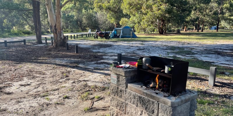
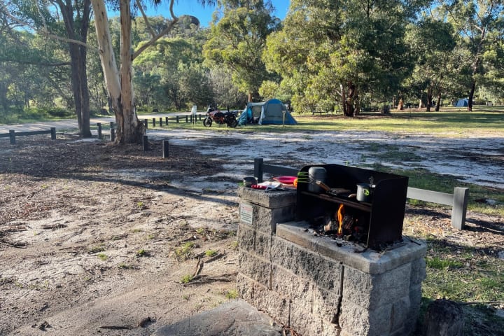
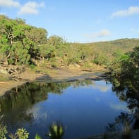
(Tent camping). Well maintained for a national park. Council fire rings are limited, so pack yourself one. The camp grounds are level and shaded. Picnics tables are placed throughout the grounds. Birds can be bold with scavenging.

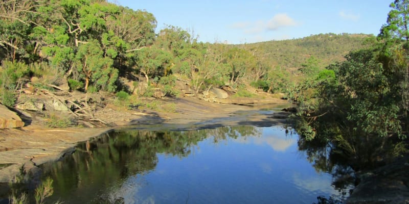
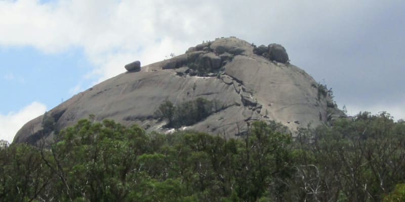
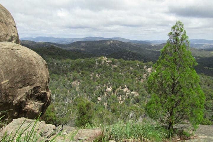
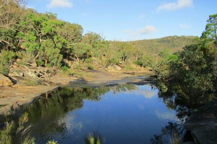
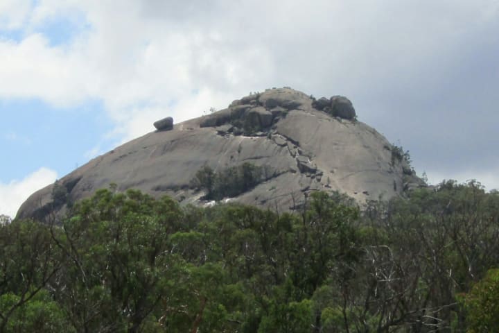
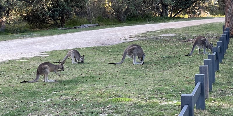
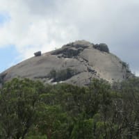
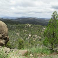
Great amenities with flushing toilets & showers (need shower bag in drought) No fires at your camp unless you bring your own fire pit. Communal wood bbq’s in day areas. Must bring own wood. Ground cover is grass and fine granite. Pegs go in well. Non potable water available. Lots of kangaroos and birds. Short walk to Bald Rock Creek. Large rocks to explore near campsite. Walks to Castle Rock and Pyramids. Information Centre 100 metres from camp. Great spot.

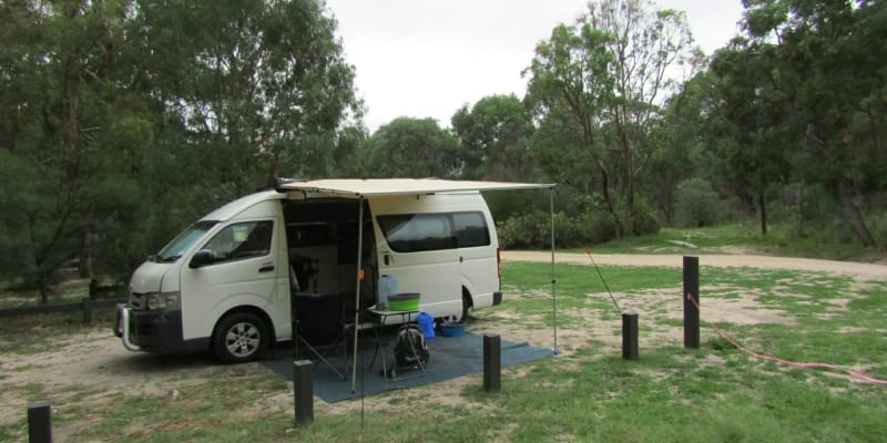
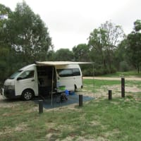
If you have a tent, camper trailer, caravan - or a campervan like us then this is a great place to camp and enjoy the spectacular rock outcrops of Girraween national park. There is bitumen road access... Read more
Location
Girraween National Park,
Queensland
/151.938113,-28.833004,9,0/300x200?access_token=pk.eyJ1IjoiYWlyY2FtcGF1IiwiYSI6ImNqdTg0aXZzNTIxYzEzeW9iN25xaG51eWQifQ.erq2STwV0mFKkODqqk7gPg&attribution=false)
Details
- Listing type
- Campsite
- Caravans
- Yes
- Management
- National Parks
- Website
- Visit
Average temperature
Closest
Caltex Wallangarra
18.73 kmChargefox (fast)
35.32 kmConvent Beach
272.09 kmYamba Main Beach
271.25 kmRelated lists
-
Top 10 National Park campgrounds near Clifton, QLD
Australia has some of the most beautiful national parks in the world. Here are our favourite 10 national park campgrounds near Clifton, QLD.
-
Top 7 rated campsites for Storm King
Nothing beats a fellow campers recommendation. We've put together the top 7 campsites in Storm King as voted by the Anycamp community.
-
Top 10 National Park campgrounds near Killarney, QLD
Australia has some of the most beautiful national parks in the world. Here are our favourite 10 national park campgrounds near Killarney, QLD.
- The top 10 warmest campsites in TAS for June
Nearby locations
Nearby campsites
-
Bald Rock Creek Camping Area
Girraween National Park, Queensland
-
Wallangarra Driver Reviver
New England Highway & Margetts Street, Wallangarra QLD, Australia
-
Wallangarra Driver Reviver Rest Stop
75-77 Margetts St, Wallangarra, Queensland
-
Jennings Rest Area
Gladstone St, Jennings, New South Wales
-
Bald Rock campground and picnic area
Bald Rock National Park
-
Country Style Caravan Park
27156 New England Highway, Stanthorpe, Queensland, 4380, AU
Alternatives nearby
-
Top of the Town Tourist Park
8 Ratings
Pets Allowed
Drinking Water
Powered sites
Showers
Swimming
Allows fires
13 km's away
$28 -
Tenterfield Lodge Caravan Park
1 Rating
Pets Allowed
Drinking Water
Powered sites
Showers
Allows fires
15.8 km's away
$35 -
Jacaranda Grove
0 Ratings
Drinking Water
Swimming
83.3 km's away
$45 -
Binna Burra Rainforest Campsite
4 Ratings
Drinking Water
Powered sites
Showers
87.6 km's away
$40 -
BIG4 Saltwater @ Yamba Holiday Park
10 Ratings
Pets Allowed
Drinking Water
Powered sites
Showers
Swimming
Allows fires
91.5 km's away
$46
