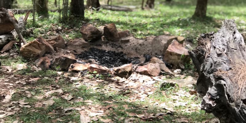
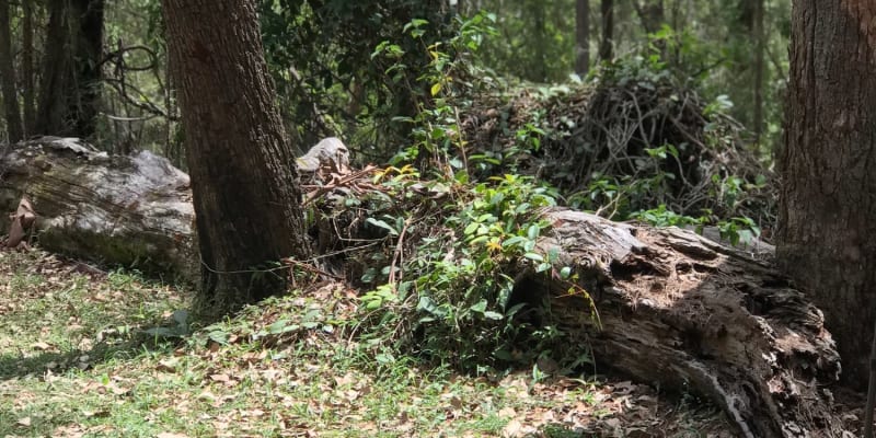
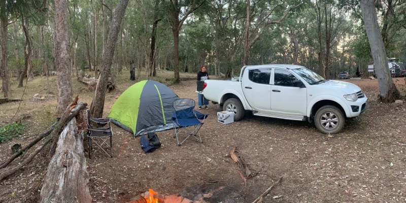
Razorback Camping Area


Features
Popular
-
Allows fires

Popular
-
Pets Allowed

-
Free

-
Toilets

-
Drinking Water

-
BBQ Areas

-
Powered sites

-
Showers

-
Swimming

-
Allows fires
Activities
-
Water slide

-
Biking

-
Hiking

-
Fishing

-
Walking Trails

-
4WD Trails

-
Bar

Type
-
Next to car

-
Allotted Site

-
Short walk to car

-
Caravans

-
Camper Trailers

-
Glamping

-
Cabins Available

-
Pub

For Kids
-
Jumping pillow

-
Horse riding

-
Kids play park

-
Organised kids activities

-
TAWK Supporters

Ownership
-
National Parks

-
State Forest

-
Independent

-
BIG4

-
Kui Parks

-
Aspen Parks

-
Discovery Holiday Parks

-
Family Parks

-
Reflections

-
Top Parks

-
NRMA

-
Holiday Haven

-
Ingenia

Access
-
Hike in

-
Car

-
4WD only

-
Disabled Access

Other
-
Firewood for sale

-
Boat Ramp Nearby

-
Wifi

-
Phone Reception

-
Dump Spot

-
Garbage

-
Swimming pool

-
Water (Non Drinking)

-
Laundry

-
Coffee Nearby

-
Boat Cleaning Facilities

-
Cafe onsite

-
4WD beach driving

-
BIG4 Breeze Holiday Parks - Cania Gorge
1 Rating
Toilets
Drinking Water
BBQ Areas
Powered sites
Swimming
20 km's away
$69 -
Captain Cook Holiday Village
8 Ratings
Pets Allowed
Toilets
Drinking Water
BBQ Areas
Powered sites
Swimming
59.4 km's away
$110 -
Fisherman's Beach Holiday Park
15 Ratings
Pets Allowed
Toilets
Drinking Water
BBQ Areas
Powered sites
Showers
Swimming
77.8 km's away
$40 -
NRMA Capricorn Yeppoon Holiday Park
9 Ratings
Toilets
Drinking Water
BBQ Areas
Powered sites
Swimming
82.7 km's away
$26 -
Bundaberg Park Village
2 Ratings
Pets Allowed
Toilets
Drinking Water
BBQ Areas
Powered sites
Swimming
92 km's away
$109
2 Reviews

Location
Razorback Track,
Kroombit Tops,
Queensland
/150.966560,-24.371747,9,0/300x200?access_token=pk.eyJ1IjoiYWlyY2FtcGF1IiwiYSI6ImNqdTg0aXZzNTIxYzEzeW9iN25xaG51eWQifQ.erq2STwV0mFKkODqqk7gPg&attribution=false)
Details
- Listing type
- Campsite
- Management
- National Parks
- Website
- Visit
Average temperature
Closest
Chargefox (fast)
125.60 kmBP Thangool
165.30 kmArthur Point Beach
222.40 kmZilzie Beach
223.07 kmRelated lists
-
Top 8 National Park campgrounds near Rockhampton, QLD
Australia has some of the most beautiful national parks in the world. Here are our favourite 8 national park campgrounds near Rockhampton.
-
Top 10 campsites that allow fires near Tablelands, QLD
They say life is better around the campfire. And we could not agree more. Over the years due to increase fire risk it's become a challenge to find great campsites that allow you to have a fire by your tent. Please be a responsible Aircamper and brush up on your fire safety knowledge. Bushwalking NSW has a great article that'll give you the rundown on how to light a fire responsibly. Below we've collected some hidden gems near Tablelands, QLD that still allow you to sit back, toast your feet and incinerate some marshmallows while telling stories about camping when you were a kid.
-
Top 10 National Park campgrounds near Capricornia Cays National Park, QLD
Australia has some of the most beautiful national parks in the world. Here are our favourite 10 national park campgrounds near Capricornia Cays National Park, QLD.
- The top 10 warmest campsites in SA for November
Nearby locations
Nearby campsites
-
Griffiths Creek Camping Area
Tableland Rd, Kroombit Tops, Queensland
-
The Wall
Via Tableland Rd, Kroombit Tops, Queensland
-
Kroombit Lochenbar Cattle Station Bush camping
Kroombit Station Road, Valentine Plains, Queensland
-
Lake Callide Retreat
119 Lake Callide Drive, Biloela, Queensland
-
BIG4 Breeze Holiday Parks - Cania Gorge
54 Park Road, Cania QLD 4630
-
Boynedale Bush Camp
Gladstone-Monto Rd, Boynedale, Queensland
Alternatives nearby
-
BIG4 Breeze Holiday Parks - Cania Gorge
1 Rating
Toilets
Drinking Water
BBQ Areas
Powered sites
Swimming
20 km's away
$69 -
Captain Cook Holiday Village
8 Ratings
Pets Allowed
Toilets
Drinking Water
BBQ Areas
Powered sites
Swimming
59.4 km's away
$110 -
Fisherman's Beach Holiday Park
15 Ratings
Pets Allowed
Toilets
Drinking Water
BBQ Areas
Powered sites
Showers
Swimming
77.8 km's away
$40 -
NRMA Capricorn Yeppoon Holiday Park
9 Ratings
Toilets
Drinking Water
BBQ Areas
Powered sites
Swimming
82.7 km's away
$26 -
Bundaberg Park Village
2 Ratings
Pets Allowed
Toilets
Drinking Water
BBQ Areas
Powered sites
Swimming
92 km's away
$109
