Warraweena Conservation Park


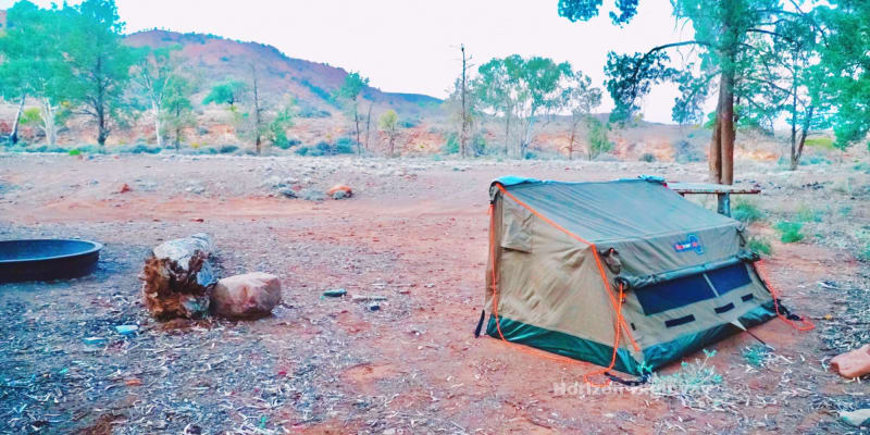

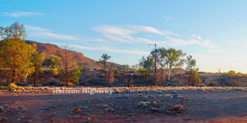

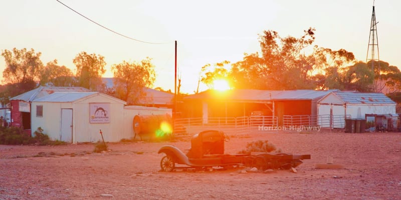

Features
Popular
-
Toilets

-
Allows fires

Popular
-
Pets Allowed

-
Free

-
Toilets
-
Drinking Water

-
BBQ Areas

-
Powered sites

-
Showers

-
Swimming

-
Allows fires
Activities
-
Water slide

-
Biking

-
Hiking

-
Fishing

-
Walking Trails

-
4WD Trails

-
Bar

Type
-
Next to car

-
Allotted Site

-
Short walk to car

-
Caravans

-
Camper Trailers

-
Glamping

-
Cabins Available

-
Pub

For Kids
-
Jumping pillow

-
Horse riding

-
Kids play park

-
Organised kids activities

-
TAWK Supporters

Ownership
-
National Parks

-
State Forest

-
Independent

-
BIG4

-
Kui Parks

-
Aspen Parks

-
Discovery Holiday Parks

-
Family Parks

-
Reflections

-
Top Parks

-
NRMA

-
Holiday Haven

-
Ingenia

Access
-
Hike in

-
Car

-
4WD only

-
Disabled Access

Other
-
Firewood for sale

-
Boat Ramp Nearby

-
Wifi

-
Phone Reception

-
Dump Spot

-
Garbage

-
Swimming pool

-
Water (Non Drinking)

-
Laundry

-
Coffee Nearby

-
Boat Cleaning Facilities

-
Cafe onsite

-
4WD beach driving

-
Moolooloo Station Farm Stay
1 Rating
Powered sites
15.7 km's away
-
Beltana Station
0 Ratings
Pets Allowed
Drinking Water
BBQ Areas
Powered sites
15.8 km's away
-
Copley Caravan Park
0 Ratings
Pets Allowed
Drinking Water
BBQ Areas
Powered sites
19.4 km's away
-
IGA Warta Community Campground
1 Rating
Pets Allowed
Drinking Water
BBQ Areas
Powered sites
Showers
Swimming
21.3 km's away
-
Angorichina Station
0 Ratings
Drinking Water
BBQ Areas
23.1 km's away
Location
Warraweena Road,
Warraweena,
South Australia
/138.637129,-30.767902,9,0/300x200?access_token=pk.eyJ1IjoiYWlyY2FtcGF1IiwiYSI6ImNqdTg0aXZzNTIxYzEzeW9iN25xaG51eWQifQ.erq2STwV0mFKkODqqk7gPg&attribution=false)
Details
- Listing type
- Campsite
- Cabins Available
- Yes
- Website
- Visit
Average temperature
Closest
Mobil Leigh Creek
67.08 kmChargefox (standard)
267.77 kmSemaphore Park Beach
558.97 kmWest Lakes Shore Beach
560.05 kmRelated lists
-
Top 10 campsites that allow fires near Lake Torrens National Park, SA
They say life is better around the campfire. And we could not agree more. Over the years due to increase fire risk it's become a challenge to find great campsites that allow you to have a fire by your tent. Please be a responsible Aircamper and brush up on your fire safety knowledge. Bushwalking NSW has a great article that'll give you the rundown on how to light a fire responsibly. Below we've collected some hidden gems near Lake Torrens National Park, SA that still allow you to sit back, toast your feet and incinerate some marshmallows while telling stories about camping when you were a kid.
-
10 campgrounds with cabins near Parachilna, SA
Enjoy nature without giving up creature comforts at these cabins near Parachilna, SA. Cabins are a great introduction to the outdoors for those curious about camping.
-
10 campgrounds with cabins near Motpena, SA
Enjoy nature without giving up creature comforts at these cabins near Motpena, SA. Cabins are a great introduction to the outdoors for those curious about camping.
- The top 10 warmest campsites in ACT for September
Nearby locations
Nearby campsites
-
Moolooloo Station Farm Stay
Moolooloo Road, Moolooloo, South Australia
-
Beltana Station
Barndioota Rd, Beltana, South Australia
-
Glass Gorge
Unnamed Rd, Blinman, South Australia
-
Copley Caravan Park
100 Railway West Terrace, Copley, South Australia, 5732, AU
-
Irish Well Hut - Nantawarrina IPA
South Australia
-
IGA Warta Community Campground
Copley Rd, Nepabunna 5732, South Australia
Alternatives nearby
-
Moolooloo Station Farm Stay
1 Rating
Powered sites
15.7 km's away
-
Beltana Station
0 Ratings
Pets Allowed
Drinking Water
BBQ Areas
Powered sites
15.8 km's away
-
Copley Caravan Park
0 Ratings
Pets Allowed
Drinking Water
BBQ Areas
Powered sites
19.4 km's away
-
IGA Warta Community Campground
1 Rating
Pets Allowed
Drinking Water
BBQ Areas
Powered sites
Showers
Swimming
21.3 km's away
-
Angorichina Station
0 Ratings
Drinking Water
BBQ Areas
23.1 km's away
